By Andy Lilienthal; photos by Mercedes Lilienthal
In part four of Around The West in 95 Horsepower, Mercedes and I had run the famous trail over Imogene Pass, as part of our first day in Ouray, Colorado.
The one thing we wanted to do in Ouray while we were there was the Imogene Pass and Last Dollar Road route, and we had competed that. If we had time and the weather would cooperate, I wanted to take Mercedes to the ghost town of Animas Forks, I wanted to visit Silverton, and if possible, visit the incredible abandoned Buffalo Boy Tram House. All of these places are nestled in uniquely scenic parts of Colorado's San Juan Mountains, which provide amazing vistas and fantastic terrain for hiking, biking, and four wheeling.
Before leaving camp we made a quick pitstop for a coffee in Ouray and a check of the forecast. It turns out the weather looked like it might hold out for the first part of the day, so we decided to go for it. Once again, I found myself brimming with excitement, not only to go exploring, but to bring Mercedes with me on this adventure.
We hopped on the legendary Million Dollar Highway towards Silverton with all of its twists, turns, sheer drop offs, and lack of guard rails. It’s a sight within itself. They were actually doing construction on part of the road, which looked like a feat of civil engineering. There were excavators on the cliff, people tied in with harnesses and ropes, and the whole thing looked as if it were cantilevered out over the canyon. I hope those workers got hazard pay.
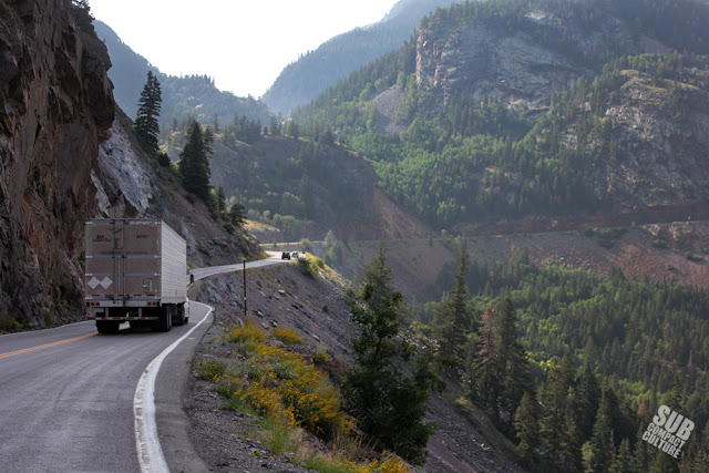 |
| Driving the Million Dollar Highway outside of Ouray, CO. Most stretches do not have any guard rails. |
We ended up going into the historic Grand Imperial Hotel, located on the dusty main drag in Silverton. The hotel was opened in 1882 and offers Victorian-style charm and tons of history. We asked a very helpful woman behind the front desk for some directions, and she happened to be well versed in the area’s trails. She recommended a full day's route that went up to Buffalo Boy, over to Animas Forks, and then to California Gulch back to the highway to Ouray. I was unfamiliar with California Gulch and the other passes around it, which include California Pass, Hurricane Pass, and Corkscrew Pass, but she said the drive was great, and as long as we had a capable vehicle, we’d make it. With this plan set, we hit the road.
BUFFALO BOY TRAM HOUSE
 |
| Tram supports on the way up to Buffalo Boy Tram House |
The trail winds through aspens, making regular 180-degree switches up the steep grade. Stunning valley views complete with wildflowers and occasional abandoned cabins dot the stunning landscape, and you eventually begin to see support poles for the tram, which is located at 12,650-feet in elevation. The combination of steepness and width make this trail a white-knuckle affair which requires your full concentration. Add to this the fact we're really having to work the Sidekick's engine and can detect that "hot smell" of coolant, and we can can see what looks like an impending thunderstorm, this trek was definitely exciting.
We reach the tram and there’s still no sign of anyone else up here at all. Other than the breeze, it’s dead silent, and then we hear thunder. It looks like it’ll be a quick visit to the tram house. We grabbed the camera and started exploring. In fact, here's quick video shortly after exiting the truck:
The tram was used to send ore down the mountain for processing. Carts would dump the ore from the top of the tram, which would go into a chute, which would be loaded in to buckets, and sent down the tram. It was built in 1929, and must’ve been quite the undertaking to construct considering the rough terrain and elevation.
 |
| Buffalo Boy Tram House |
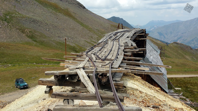 |
| The top rails at the Buffalo Boy Tram House |
 |
| A marmot popping its head out from a hole in the ground at the Buffalo Boy Tram House site. |
ANIMAS FORKS
 |
| Some of the abandoned buildings in the ghost town of Animas Forks. |
Once a thriving mining town, Animas Forks, located at 11,200 ft., was established in 1873. At one time it had a hotel, general store, saloon, and even a newspaper. However, now all that’s left are a handful of former dwellings and some mining ruins.
The people that lived here must’ve been extremely hearty, as the area can get feet of snow at a time. And back when the town was buzzing, people would be home-bound for months at a time. It wouldn’t have been an easy life. In fact, in 1884, there was a 23-day blizzard that dumped an astounding 25-feet of snow.
When the mines were depleted, the town was abandoned, and by the 1920s, the place was deserted. Nowadays, Animas Forks brings in nearly 100,000 visitors a year. The structures that still exist are maintained just enough to make them relatively safe for people to walk through, although you'd best watch your step. It’s a pretty incredible place.
 |
| Frisco Mine building outside of Animas Forks. |
 |
| Another shot of the Frisco Mine building |
 |
| En route to California Gulch in the Teal Terror. |
CALIFORNIA GULCH, CORKSCREW PASS, AND HURRICANE PASS
We headed west on Country Road 9, passing a few other abandoned structures. After some time, we met up with County Road 19 and entered California Gulch.
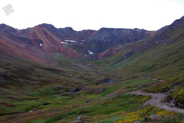 |
| California Gulch, with its winding trail, was one of the most beautiful places I'd ever been. |
We continued down the trail, ascending several steep switchbacks until arriving at California Pass, which sits at 12,960-feet.
 |
| Click to for larger view of California Pass panorama |
 |
| One of the few 4x4s we saw on California Pass. |
We headed down the twisty trail, which clung to the mountainside and felt more like a mountain goat path than a vehicle path. A few of these turns were extremely sharp and required three-point maneuvers to negotiate—even in the Sidekick.
We eventually came upon Hurricane Pass (12,730-feet), and soon found ourselves on the aptly named Corkscrew Pass. With twists, turns, and stunning views of rust-colored mountains, Corkscrew Pass was an unexpected treat.
 |
| These peaks in the San Juan Mountains were filled with a myriad of color. |
Man, what a day.
 |
| With a lack of guardrails, you've got to pay attention on the Million Dollar Highway. |
LAST NIGHT IN OURAY
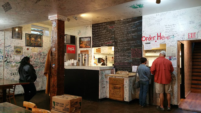 |
| The graffiti-covered walls of Maggie's Kitchen in Ouray, CO |
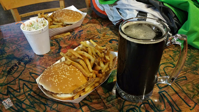 |
| Fantastic burgers, fries, coleslaw, and beer (From Mr. Grumpy Pants Brewing) at Maggie's Kitchen. |
This day’s adventures were simply amazing. The weather held out (mostly), we saw what we wanted (and more), and ended up having more of an adventure than we ever could had anticipated. It's proof that even when things don't go as planned, they can end up being even better than expected. It was also a reminder about travel in general: You've got to be flexible in your plans.
The next day we’d depart Ouray for possibly one of the most famous adventure destinations in the U.S.: Moab.
LINKS
Around the West in 95 Horsepower: Imogene Pass
Around the West in 95 Horsepower: Murtaugh to Ouray
Around the West in 95 Horsepower: Portland to Murtaugh
Around the West in 95 Horsepower: Intro and Preparation


No comments:
Post a Comment